![]()
Lessons learned from revisiting, reviewing and revising previous artwork through four illustrated maps of Tenerife
In 2017, I visited the Spanish island of Tenerife for the first time on a round trip. During my holiday, I drew the places we visited and our activities and adventures. I then created a map from these very personal drawings.
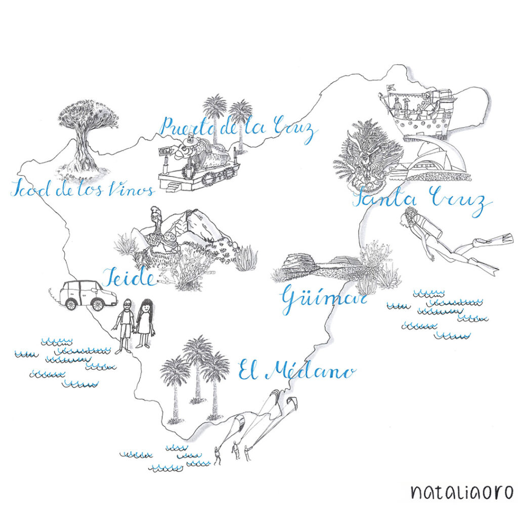
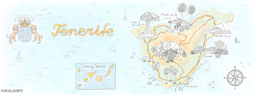
In 2019, I reviewed this map and used the line drawings as a starting point for my first illustrated map for They Draw and Travel. The final illustration was a mix of black and white line drawings and coloured elements in a naive pencil drawing style, but created 100% digitally in Procreate on the iPad.
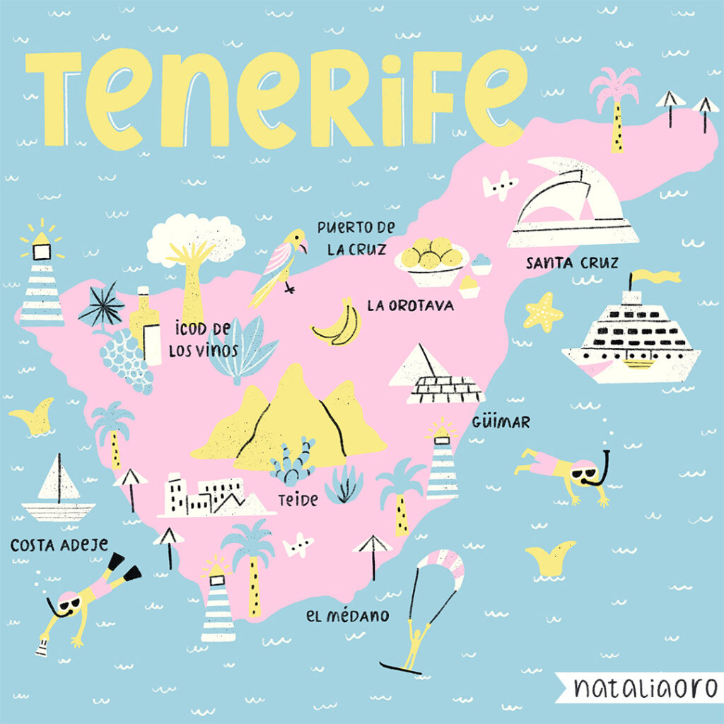
A few years later, in 2021, I revisited this map while working on a collection of island maps. I focused on the more iconic points of interest from a tourist perspective for people on holiday. The style and medium I used changed – I worked in Procreate on the iPad, choosing a consistent colour palette and style for a collection of other illustrated island maps.
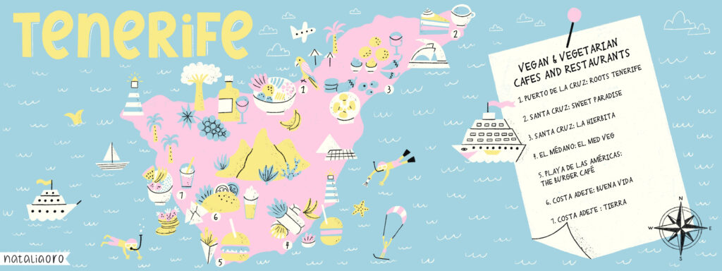
In 2023 I reworked the 2021 map, taking as a starting point the outlines of the islands, the main points of interest, the typography and some icons. I worked in the same medium and style, but changed the theme of the illustrated map, focusing on vegan and vegetarian food in this Canary Island. I also changed the layout of the map to follow the They Draw submission guidelines and added a list of my restaurant suggestions.
Lessons learned:
-Creating a version of a map helps you make progress quickly. You don’t have to start from scratch, as the main points of interest are already researched and you have a good understanding of the topic.
-Defined style, colour palette, typography, layout help to create a collection that works well together (and helps to work quickly on an illustration.)
-Focus on one topic for a map – helps to illustrate the most important information and not to overdo the illustration.
-Clear style and simple icons make the map easier to read.